Popular Resources
View AllFAQs
View AllUS House of Representatives: District 13 Map
US House of Representatives: Brad Knott (R)
US Senate: Ted Budd (R) and Thom Tillis (R)
NC General Assembly House: Districts 6 and 53 Map
NC General Assembly House: Joseph Pike (6, R), Howard Penny Jr. (53, R)
NC General Assembly Senate: District 12 Map
NC General Assembly Senate: Jim Burgin (R)
County Commissioners Districts map
| District Number |
Commissioner |
Population (Estimation) |
Acreage |
Square Miles |
Road Miles |
| 1 | Barbara McKoy | 30,715 | 72,403 | 113.13 | 382.95 |
| 2 | William Morris | 33,445 | 69,801 | 109.07 | 393.25 |
| 3 | W Brooks Matthews | 31,285 | 69,699 | 108.91 | 416.37 |
| 4 | Duncan Edward Jaggers | 33,925 | 106,137 | 165.84 | 510.26 |
| 5 | Matthew Nicol | 26,038 | 66,667 | 104.17 | 299.78 |
North Carolina Office of State Fire Marshal
| Fire District Name |
Population (Estimation) |
Acreage |
Square Miles |
Road Miles |
| Anderson Creek | 17,080 | 16,101 | 25.16 | 142.64 |
|
Angier Black River |
16,090 |
22,373 |
34.96 |
182.03 |
| Benhaven | 13,025 | 33,428 | 52.23 | 174.64 |
| Benson | 893 | 3,278 | 5.12 | 16.82 |
| Boone Trail | 9,228 | 48,979 | 76.53 | 190.67 |
| Buies Creek | 8,230 | 15,804 | 24.69 | 92.95 |
| Coats Grove (In Town) (Out of Town) |
8,880 2,778 6,102 |
21,597 1038 20,559 |
33.75 1.62 32.13 |
121.55 21.82 99.73 |
| Crains Creek | 855 | 4,084 | 6.38 | 18.37 |
| Cypress Pointe | 983 | 5,884 | 9.19 | 23.13 |
| Dunn (In City) (Out of City) |
15,418 11,008 4,410 |
25,573 4,676 20,897 |
39.96 7.31 32.65 |
206.38 97.26 109.12 |
| Erwin (In Town) (Out of Town) |
9,850 5,220 4,630 |
23,718 2,809 20,909 |
37.06 4.39 32.67 |
131.15 48.31 82.84 |
| Flat Branch | 5,550 | 30,430 | 47.55 | 110.70 |
| Fort Bragg | 3,695 | 15,105 | 23.60 | 17.65 |
| Fuquay-Varina | 0 | 0.37 | 0.0006 | 0 |
| Godwin Falcon | 58 | 189 | 0.30 | 1.12 |
| Lee Fire Station 5 | 0 | 3.7 | 0.006 | 0 |
| Lillington (In Town) (Out of Town) |
5,920 4,540 1,380 |
15,360 |
24.00 9.11 14.89 |
89.19 60.92 28.27 |
| Northwest Harnett | 10,955 | 37,808 | 59.07 | 165.72 |
| Spout Springs | 18,943 | 27,287 | 42.64 | 187.46 |
| Summerville Bunnlevel | 9,365 | 43,053 | 67.27 | 159.99 |
| West Johnston | 595 | 1,263 | 1.97 | 8.98 |
| Westarea Station | 573 | 2,290 | 3.58 | 9.05 |
NC Office of State Budget and Management: Population and Demographics
|
Year |
Population |
Parcel Count |
Roads Miles |
|
2026 |
80,776 |
2003.62 |
|
|
2025 |
78,659 |
1994.42 |
|
| 2024 | 74,842 | 1953.52 | |
| 2023 | 71,372 | 1930.28 | |
| 2022 | 69,223 | 1892.37 | |
| 2021 | 68,033 | 1883.54 | |
| 2020 | 133,568 | 67,834 | 1879.21 |
| 2019 | 66,413 | 1860.57 | |
| 2018 | 65,991 | 1857.92 | |
| 2017 | 65,546 | 1856.22 | |
| 2016 | 65,330 | 1855.84 | |
| 2015 | 65,305 | N/A | |
| 2010 | 115,773 | N/A | N/A |
*We retain data as far back as 2015

The Legend icon gives a key to distinguish what each active layer is representing.
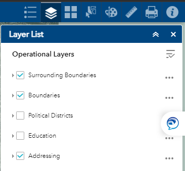
The Layer List icon allows you to activate or deactivate each available layer in the Viewer allowing for a custom experience to aid you in what you are looking for.
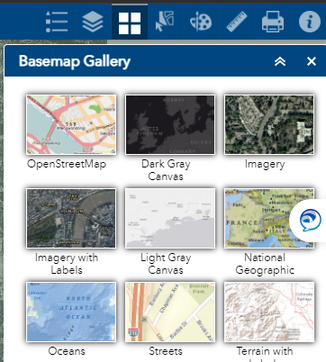
The Basemap Gallery icon lets you choose which underlying imagery you wish to have while exploring the map. By default, we have the 2021 Aerials active, but you can access older aerials as far back as 2005 as well as basemaps from other sources like OpenStreetMap.
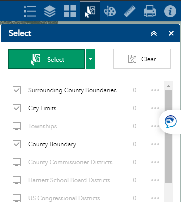
The Select icon allows you to manually select multiple features depending on which layers you toggled for selecting.
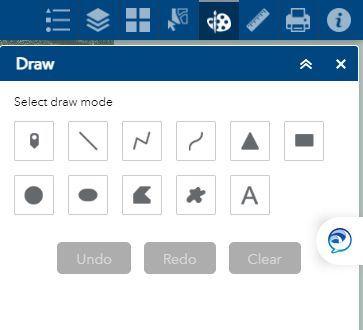
The Draw icon allows you to mark and draw temporary features of your own. There is a toggleable option for measurements but the next tool is more specialized for that.
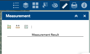
The Measurement icon allows you to measure areas of polygons, distances of lines, the latitudes and longitudes of points.

The Print icon will create a printable document of whatever section of the map you are zoomed in on. This comes with a legend, scale, and north arrow. NOTE: Fully encapsulating what you are trying to screenshot may take multiple tries to angle it just right. NOTE: Screenshot maps from the Viewer are for reference only and ARE NOT FOR LEGAL USE unlike official surveys recorded at the Register of Deeds.
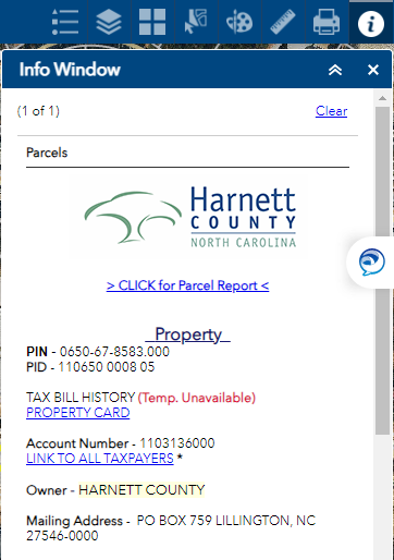
The Info Window icon displays available information for selected features, especially for tax parcels. For this feature type one can learn from this window: PIN/PID, current owner(s), tax history, acreage, deed history, surveys, value, zoning, environmental features (flood zone, soil quality etc,), and much more as detailed in the info window dropdown below. NOTE: Almost all of this information comes from other Harnett County Departments more specialized on these matters and we highly recommend you call them if you have questions for such thing. For instance; for tax questions, please call Tax at (910-893-7520) and so on for the following; Register of Deeds (910-893-7540, deeds and surveys), Planning and Development (910-893-7525, zoning, permits), Board of Elections (910-893-7553, elections, polling times and places), Clerk of Court (910-814-4600, wills)
If you are searching for a tax parcel in Harnett County and do not know where exactly it is, our search and advanced search tools are there to help!

The Search Engines can be found at the upper left hand corner of the viewer, the main search engine is immediately available while advanced search is made available through a pull-out tab. The utilize these, you will need a Unique Identifier.
A Unique Identifier is something exclusive to a tax parcel. An obvious one is address. Simply enter it into the the search bar (usually number and street name will be enough to narrow it down) and you are set! However, many parcels do not have this. In particular, any undeveloped lot, such as farmland or woodland, will not have an address as to get an address for a lot, one first needs a building permit. Inversely you could have a parcel with multiple addresses (Condos, trailer parks, etc.) but this latter instance usually isn’t a problem for searching by address. Fortunately, this is not the only unique identifier.

ALL tax parcels have PINs and PIDs as unique identifiers. If you receive taxes on the property you are searching for, these will almost certainly be on it. If you have the most recent deed information the parcel, you can go to the Register of Deeds search engine and enter it. If the deed was done sometime in the last couple decades, it will definitely have the PID, PIN or both.
PINs have a format of XXXX-XX-XXXX.XXX with no spaces and are very easy to search with.
PIDs are a bit more tricky as it is actually multiple sub-identifiers, based on the lot’s region, subdivision, lot etc., that form a greater number. The format of PIDs is XX|XXXX|XX|XX|XXXX|X|XX|X. If one of the sections have no number, it is substituted with spaces. For example, the PID for the parcel containing the Harnett County Courthouse is 110650 0008 05 or 11|0650|__|__|0008|_|05|_. The former number is what has to be entered, with the correct number of spaces (spaces after the last number do not need to be entered) to effectively search for the Courthouse by PID
Another way to search for a property is via the name of the owner, but for this it would be best to use advanced search. This is because this method can get multiple results and advanced search can display such results better.
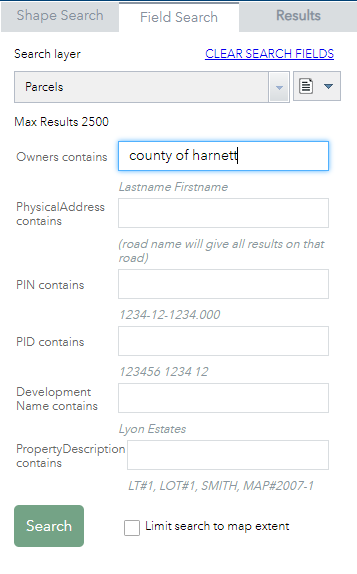
Advanced Search allows you to search with optimization based on what exact details you you looking for. In addition to searching by address, PIN, or PID, you can also search by: owner, development, or property description. If the owner is a person, you must search via the format; Last Name, First Name, Middle Initial. If the owner is an organization, simply enter the name of it.
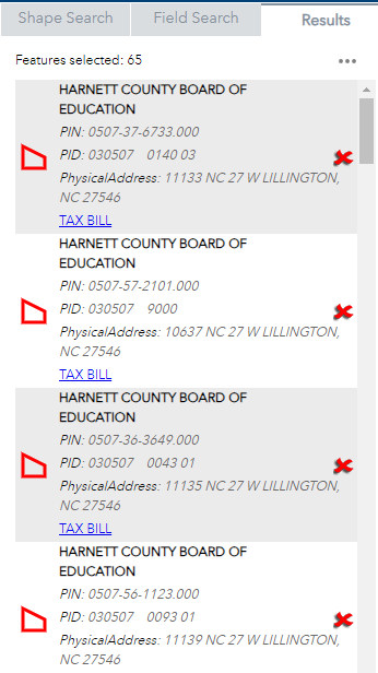
For the average homeowner, you will most likely just get one return. But others, like developers, government institutions, and farmers may get multiple returns and you will have to scroll through the results carefully while cross-referencing with other information to find the property you are looking for.
The Info Window offers information or links to information regarding a selected feature, especially for tax parcels. NOTE: Almost all information on the info window comes from other departments. If you have any questions regarding the below information, it would be best to contact them about it rather than us. For instance, for questions regarding property tax and land value, please call the Tax Department at (910-893-7520) and so on: Register of Deeds (Deeds and surveys, 910-893-7540), Planning and Development (Permits, zoning, 910-893-7525), Board of Elections (Voting information, 910-893-8151), Board of Education (School zones, 910-893-8151), Environmental Health (Soil quality, wetlands, flood zone, 910-893-7547), Clerk of Court (wills, 910-814-4600)
![]()
The link, “CLICK for Parcel Report” will lead to a printable screen of general information concerning the parcel along with an image encapsulating it. NOTE: Screenshot maps from the Viewer are for reference only and ARE NOT FOR LEGAL USE unlike official surveys recorded at the Register of Deeds.

The PID and PIN are unique identifiers possessed by all tax parcels. PINs have a format of XXXX-XX-XXXX.XXX. PIDs have a format of XX|XXXX|XX|XX|XXXX|X|XX|X with spaces as a substitute if one of the slots isn’t filled.

The link ‘Tax Bill History’ shows the list of all previous taxpayers associated with the property. ‘Property Card’ links to the Property Card which heavily describes the property, especially the building(s) on it.

The ‘Account Number’ is a serial number serving as a unique identifier, mostly for clerical reasons, for the tax account associated with the property owner. The ‘owner’ section lists the primary and secondary owners of the tax accounts. Peoples names are structured Last Name, First Name. To see any other owners associated with this parcel, please check ‘Link to all Taxpayers’

The Mailing Address is the address to where tax bills concerning the property are sent. The physical address is the primary address of the property itself. NOTE: Some properties, like condos and trailer parks, may have multiple addresses associated with them.
![]()
Description shows any miscellaneous information about the property, most notably its lot number, subdivision name, who requested the survey, the survey reference, or some combination thereof. For instance, Harnett County Courthouse has the description ‘LOT#2 HARNETT COUNTY MAP#2019-146’ or; Lot 2, requested by Harnett County, survey 2019/146.
![]()
‘Surveyed or Deeded Acreage’ is acreage given by the most recent survey affecting the acreage of the property. ‘Calculated Acreage’ is the result of an area calculator applied to the tax parcels. When in doubt, the surveyed acreage takes precedence.

The Deed section shows; the date of the most recent deed associated with the parcel, the book and page of said deed, the link to the deed on the Register of Deeds website, and a link showing the history of all deed associated with the parcel.

The Survey section shows the book and page of the parcel’s most recent survey and has a link to it on the ROD website. NOTE: Any survey made prior to the year 2000 did NOT have to be recorded at the Register of Deeds. So older houses and tracts of undeveloped land that have not changed in decades may well have nothing on them at all. NOTE: Surveys made from 2000 onward have a system where the book is also the year it was recorded. Pre-2000 surveys instead either use the map book (MB) system or the Plat Cabinet (PC) system. PC surveys have to be entered as ‘PC#’ and then the book letter. NOTE: Pre-2000 surveys will probably not be entered into the linkage system but can most likely still be found in the legal description allowing one to manually search for the survey at the Register of Deeds website.

The Sales section shows when the property was last sold, the price of the sale, its qualification for use by the NC Dept of Revenue for the Sales Assessment Ratio Studies, whether it was a vacant or improved lot at the time of construction, and whether it was a full transfer of ownership or was created by breaking a piece off of a larger lot.

The Structure section tells the year the primary structure was built, the sum sq/ft of all buildings, and how many buildings are on the lot. A lack of information means the appraisers have not put a value on the building, usually because they are exempt from taxes and have not been prioritized.
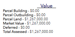
The Value section breaks down the assessed value of the lot by building, outbuilding, land and total.
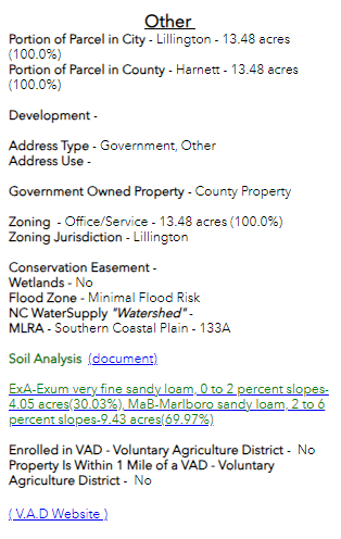
The Other section hosts and large amount of miscellaneous information including; zoning, soil information, watershed, flood zone, wetlands, address type, percentage of lot within county or city boundaries, and others.

The Education section shows what primary, elementary, middle, and high school districts the parcel lies in.
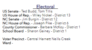
The Electoral section shows which voting district the parcel lies in for the: US Senate and House of Representatives, NC Senate and HOR, County Commissioner, and School Board. It also shows the Voter Precinct and Ward if relevant.

The Emergency Services section shows what Fire Department, Police District, and Emergency Medical Services (EMS) the property is within.

The Utilities section shows who provides service for Electricity and Telephone for the property.
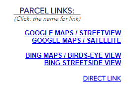
The Parcel Links section lets you view the property on Google Maps, Bing Maps, or open a new Viewer window centered on the property.


